RAMALLAH, August 20, 2025 (WAFA) – A position paper issued by the Colonization and Wall Resistance Commission stated that the Israeli colonial project in the Palestinian territories is based on seizing and expropriating the largest possible areas of Palestinian land, Judaizing them, and undermining any chance of establishing a sovereign Palestinian state with East Jerusalem as its capital.
Since its occupation of Palestinian territories in 1967, the occupation authorities have worked at an accelerating pace to seize and Judaize as much land as possible, especially in Jerusalem, in order to alter the city’s Arab historical landmarks and Palestinian demographic character. One of the most important colonial schemes is the 'E1 Plan'. The occupation approved Master Plan (E1) No. (4/420) in 1999, covering an area of 12,000 dunums, most of which were declared 'state land' and later annexed to the Ma’ale Adumim settlement. In 2012, the E1 Plan was further approved, which includes the following subplans:
- Plan No. (2/4/420) seizes 1,350 dunums to establish an industrial zone northwest of the E1 area.
- Plan No. (9/4/420) seizes 180 dunums to establish a police headquarters for the occupation, which has already been built in order to expand areas of control.
- A plan to confiscate 500 dunums from the lands of Anata and Shuafat for the establishment of a waste dump, which will later be converted into a public park for settlers.
"Three detailed construction plans: Plan (10/4/420) to build 2,176 housing units; Plan (3/4/420) to build 256 settlement units in addition to 2,152 hotel rooms; and Plan (7/10/420) to build 1,250 units, along with a colonial plan to establish a Torah Garden to the northwest of the mentioned project."
In addition, there is the 'Fabric of Life Road' plan, part of which has been completed near the annexation and expansion wall east of Anata up to al-Za’im, while another section is proposed to extend from al-Za’im to al-Eizariya. This road aims to facilitate the implementation and development of construction plans within the mentioned project and is also proposed in the future to divert the Jerusalem–al-Eizariya road and prevent Palestinians from using it.
Objectives of the E1 Plan
• Isolating Jerusalem from its Palestinian surroundings and cutting the geographic and demographic continuity between Jerusalem and the Palestinian communities, thereby undermining the establishment of a Palestinian state with Jerusalem as its capital.
• Isolating the northern West Bank from its southern part and turning it into disconnected enclaves subject to the movement restrictions of the occupation authorities.
• Expanding the borders of East Jerusalem through the annexation of the Ma’ale Adumim settlement bloc.
• Expelling and displacing the Bedouin communities once again from their lands.
• Increasing the number of Jews in Jerusalem at the expense of the original Palestinian population, especially after removing Palestinian communities such as Kafr ‘Aqab, Anata, and Shu‘fat.
• Forcible transfer of the Bedouins in order to implement the E1 colonial settlement plan.
• The process of forced displacement of the Bedouins is not new, but rather a continuation of previous displacements in 1948 and 1967, starting in the Naqab (Negev) and later in the Jordan Valley under false pretexts, such as declaring these areas “closed military zones.”
• The occupation authorities seek to displace 46 Bedouin communities in the eastern slopes and the Jordan Valley in order to implement their Judaization and colonial settlement schemes and to empty the eastern borders of Palestinian presence, which cover an area of about one million dunums. In recent years, the occupation has attempted to find alternatives to relocate the Bedouins, such as the “al-Jabal area in al-‘Eizariya, al-Nuway‘ma, and the Fasayil area in Jericho.”
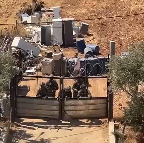
However, the steadfastness of the residents in these communities has prevented the implementation of these plans. These schemes are not separate from other colonial policies against Palestinian communities, such as the Abu Nuwar community, whose school was demolished more than three times in one year, and the Khan al-Ahmar community, which is under a demolition and displacement order in the coming April, in favor of an expansion plan for the Kfar Adumim settlement area.
Recent Israeli Measures Regarding the Jabal al-Baba Community:
Jabal al-Baba is located on the lands of al-‘Eizariya, on the northeastern outskirts of Jerusalem, in the area known as E1. The lands on which the community is situated cover about 2,400 dunums, including 36 dunums owned by the Vatican Church, which Israel seeks to seize in order to expand the settlements and advance its plan to establish what is called “Greater Jerusalem.”
This community has been subjected to repeated attacks and demolitions. Since Benjamin Netanyahu became Prime Minister in 2009 until today, around 52 homes and a kindergarten have been demolished, some of them more than once. If the new decision of the occupation authorities is implemented, 57 families — more than 300 Bedouin residents — will be forcibly displaced.
The families of the Jabal al-Baba community originate from the Tel ‘Arad area in the Naqab (Negev), from which they were entirely displaced in 1948, and later again after the occupation of Jerusalem in 1967.
On October 4, 2007, the Israeli occupation forces revealed a plan for the eastern area of occupied Jerusalem by issuing Military Order No. 07/19/T, which stipulated the confiscation of 1,128.9 dunums of Palestinian land in Abu Dis, Arab al-Sawahra, Nabi Musa, Khan al-Ahmar, and Jabal al-Baba, under the pretext of “military purposes” and for the establishment of the so-called “Fabric of Life Road.”
The current military order, signed by the commander of the central area, is dated November 1, 2017, and stipulates that: “Eight days after the publication of this announcement, the owners of any property located in the declared area must remove it from the site in accordance with this order.” The order further prohibits any construction activities in the designated area, as well as the entry of persons or property for construction purposes.
The Ma’ale Adumim settlement bloc is one of the largest Israeli settlement blocs in the West Bank, which Israel intends to maintain under its control in any future settlement arrangement, and to annex to Jerusalem through the implementation of the “Greater Jerusalem” plan (Figure 1). This plan includes the construction of the annexation and expansion wall around Jerusalem and the expansion of its boundaries to encompass the three surrounding Israeli settlement blocs:
• The Ma’ale Adumim bloc to the east
• The Giv’at Ze’ev bloc to the north
• The Gush Etzion bloc to the south
Connecting these settlements to East Jerusalem and, from there, to the territories occupied in 1948 aims to create geographic continuity between the settlement blocs on one hand, and on the other, to isolate and exclude Palestinian communities historically linked to the city, thereby depriving them of their historical right to it.
The Mayor of the Ma’ale Adumim settlement is pushing to build in various sites around Jerusalem within the E1 plan, including the construction of a large amusement city covering 800 dunums, consisting of a park, artificial lake, sports fields, and hotels aimed at attracting tourists. In addition, a new settlement neighborhood called “Mevaseret Adumim” is planned, with more than 3,000 housing units, with the goal of linking East Jerusalem to the Jordan Valley and further to the eastern borders.
The occupation authorities also aim to link the Kidar settlement with Ma’ale Adumim by building in the area between the two settlements.
T.R.